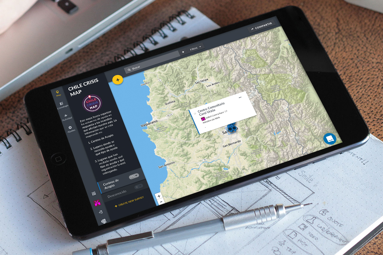
How can maps help organizing aid efforts in emergencies?
As a response to the emergency situation that Chile faced during a succession of wildfires, I developed this tool in partnership with the Chilean community in the US and non-profit organizations in Chile. The objective was to organize aid efforts by geo-localizing gathering centers and needs. As a result, the platform, developed using open source code, helped coordinate the efforts of many organizations and the tool is now widespread among emergency organizations and ready to use for future situations in the country.